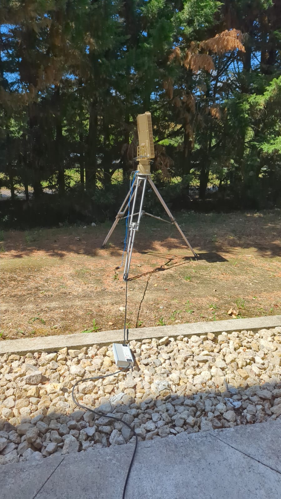
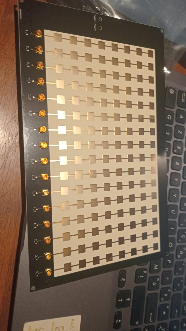
Open-Source Radar Simulation

AERIS-10 Multi-Radar
Situational Awareness

Open-source phased array radar simulation for Microsoft Fabric

Five simulated AERIS-10 radars tracking a UAV flight path over Kangasala, Finland — streaming detections through real-time sensor fusion and analytics on the Microsoft Fabric platform.

Open Dashboard
About the Project

Project Overview

A multi-container radar simulation demonstrating real-time sensor fusion and streaming analytics.

What

A multi-container simulation of five AERIS-10 phased array radars. Each radar runs as an independent process, generating realistic range-Doppler detections for a UAV target traversing Finnish airspace.

Why

Demonstrates how real-time sensor fusion and streaming analytics can be built on Microsoft Fabric — from raw radar returns through detection, fusion, and visualization in a single integrated platform.

Based On

Built on the open-source AERIS-10 radar model by NawfalMotii79/PLFM_RADAR, extended with multi-radar orchestration, sensor fusion algorithms, and Fabric integration.

Radar Models

Radar Specifications

Two AERIS-10 variants provide layered coverage — long-range surveillance and short-range precision.

AERIS-10 Radar System
AERIS-10 Antenna Array
AERIS-10 Phased Array Antenna
Parameter AERIS-10N (Nexus) AERIS-10X (Extended)
Max Range3 km20 km
Frequency10.5 GHz10.5 GHz
Antenna8×16 Patch Array32×16 Slotted Waveguide
Beam Steering±45° Electronic±45° Electronic
Output Power~16 W (1 W × 16)~160 W (10 W × 16 GaN)
Range Bins6464
Doppler Bins3232
Range Resolution~47 m~312 m
Deployment

Radar Placement Map

Five radars positioned around Kangasala, Finland, with overlapping coverage zones tracking a north-to-south UAV flight.

System Design

Architecture

Distributed radars stream detections to a central fusion engine. Fused situational awareness flows to a live dashboard and Microsoft Fabric for real-time and historical analytics.

R1AERIS-10X
R2AERIS-10X
R3AERIS-10N
R4AERIS-10N
R5AERIS-10N
Analytics & Fusion SNR-weighted estimation · GDOP
Web Dashboard Real-time map & controls
Event Hub Streaming ingestion
Microsoft Fabric
EventhouseKQL real-time queries
LakehouseDelta Lake storage
Power BIOperational dashboards
ESRI ArcGISGeospatial analytics
Results

Key Findings

Insights from running the multi-radar simulation against a realistic UAV flight profile.

📡

Layered Detection

20 km radars provide early warning while 3 km radars deliver high-resolution tracking as the target enters their coverage.

🎯

Multi-Radar Triangulation

Cross-bearing and trilateration from multiple radars dramatically improve position accuracy versus any single sensor.

Real-Time Fusion

SNR-weighted position estimation with Geometric Dilution of Precision (GDOP) confidence scoring at each time step.

🐳

Containerized

Each radar runs as an independent Docker container, enabling flexible deployment and horizontal scaling.